Kinder Downfall from Hayfield

Starting from Hayfield, Derbyshire, this Peak District walk visits Kinder Downfall. Starting from the point where the Mass Trespass began, the route uses William Clough to reach the plateau. Descent is via Kinder Low and Edale Cross back to the start.

Technical sheet

292948
A Hayfield walk posted on 04/07/16 by Walking Britain. Last update : 10/08/21
  • Walking
    Activity: Walking
  • ↔
    Distance: 13.54 km
  • ◔
    Calculated time: 5h 15 
  • ▲
    Difficulty: Moderate

  • ⚐
    Return to departure point: Yes
  • ↗
    Vertical gain: + 477 m
  • ↘
    Vertical drop: - 465 m

  • ▲
    Highest point: 632 m
  • ▼
    Lowest point: 220 m
  • ⚐
    District: Hayfield 
  • ⚑
    Start/End: N 53.37852° / W 1.93029°

  • Today’s forecast: … Loading…
Kinder Downfall

Description

(S/E) This walk starts from the small quarry just outside Hayfield (grid ref SK047868) where the famous Kinder Trespass started. Leaving the car park head north east up the lane to reach the main gates of the Kinder Reservoir. Then take the footpath that climbs along the northern side of the reservoir with a good view of Kinder Downfall across the water.

(1) Soon you reach William Clough, which starts at the end of the reservoir. Keep to the path that follows the stream in this narrowing valley. After a steady climb you reach the paved "Pennine Way" at Ashop Head. Turning right (south east) climb the plateau edge. The climb is steep but on a pitched path and by the time you reach the plateau the uphill work for the day is complete.

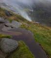
(2) Keep to the main path that follows the plateau edge - the walking is easy and the rocky defile of Kinder Downfall is reached quickly. Don't be disappointed if there is little water cascading off the plateau as it is only on rare occasions when there is a dramatic amount of water present. With plenty of shelter behind rocks, it is a good place to linger even on a cold and windy day.

(3) Turn south to follow the edge keeping to the main path, which avoids most of the bad peat groughs. The trig point of Kinder Low is reached and from here it is better to continue past Edale Rocks to reach the col (spot height 533) where the Pennine Way comes up from Edale. Turn right (west) to pass the ancient Edale Cross and head down Oaken Clough.

(4) There are many possible routes back to the quarry but it is best to leave the rather stony track just beyond Stony Ford to take the path that contours across the hillside. Continue past the foot of Kinderlow End and then turn west to Tunstead Clough Farm. From here it is only a short stroll back to the quarry(S/E).

Waypoints

  1. S/E : km 0 - alt. 239 m - Quarry
  2. 1 : km 2.48 - alt. 306 m - William Clough
  3. 2 : km 4.42 - alt. 569 m - Follow the plateau edge
  4. 3 : km 6.35 - alt. 595 m - Kinder Downfall - Turn south
  5. 4 : km 10.06 - alt. 486 m - Stony Ford
  6. S/E : km 13.54 - alt. 251 m

Useful Information

Always stay careful and alert while following a route. Visorando and the author of this walk cannot be held responsible in the event of an accident during this route.

Reviews and comments

4.3 / 5
Based on 6 reviews

Clarity of route description
4.3 / 5
Clarity of route map
4.2 / 5
Walk interest
4.3 / 5
Derek Millington
Derek Millington

Overall rating : 4.7 / 5

Date of walk : 01/08/22
Clarity of route description : ★★★★★ Very good
Clarity of route map : ★★★★☆ Good
Walk interest : ★★★★★ Very good

Excellent views over to Manchester, Stockport and the Cheshire Plain. Also back towards Edale and beyond on what was a beautiful day for walking having done the walk on a previous occasion when the weather was atrocious - heavy constant rain for the duration of being 'on the tops'.
One of the best walks I have done (second only to the Combs Moss walk, walked earlier this year) notwithstanding the effort required to get to the tops for the views!
For me and my son, the start and finish location was Hayfield.

wall19
wall19

Overall rating : 5 / 5

Date of walk : 05/08/21
Clarity of route description : ★★★★★ Very good
Clarity of route map : ★★★★★ Very good
Walk interest : ★★★★★ Very good

Following this route was easy. We made it to the Downfall in bad weather and the normally trickling stream was a raging torrent. We could not cross it even further up stream so turned back. The path down was now also a fast flowing stream. It was a great experience.

mrhaanman
mrhaanman

Overall rating : 5 / 5

Date of walk : 18/01/20
Clarity of route description : ★★★★★ Very good
Clarity of route map : ★★★★★ Very good
Walk interest : ★★★★★ Very good

A beautiful walk with amazing views. It's a challenging walk to the plateau but once up there you're rewarded with a constant panoramic view of the valley for the next hour or so. Well worth the effort getting up there.
A couple of words of warning though.
Firstly, there is very limited parking around the area. The pay car park is very small and along with the main road leading to it, fills up quickly. Make sure you set off early!
Be very careful on the ascent of William Clough in cold mornings. Ice on the rocks can make it very slippery and its easy to lose footing on the way up. Stick to treading on smaller sized stones to spread weight and grip rather than large slippery rocks and you'll be fine.

Familyharrison
Familyharrison

Overall rating : 4.7 / 5

Date of walk : 09/04/19
Clarity of route description : ★★★★★ Very good
Clarity of route map : ★★★★☆ Good
Walk interest : ★★★★★ Very good

We thoroughly enjoyed this walk. The weather was lovely and the views spectacular. A great climb up through the stream running down the hill. Nice walk along the plateau edge, and a gentle walk down Oaken Clough and back over the fields to the start point. Wonderful day.

amarlow
amarlow

Lovely walk. The weather was very kind to us and the views were spectacular. Walking up William Clough was quite a challenge but worth it.

Hillwalkers
Hillwalkers

Overall rating : 1.7 / 5

Date of walk : 11/11/17
Clarity of route description : ★☆☆☆☆ Very disappointing
Clarity of route map : ★★★☆☆ Average
Walk interest : ★☆☆☆☆ Very disappointing

We were not able to do the walk as the path we were supposed to follow was blocked off to the public and we were not able to get near Kinder reservoir.

paul9448
paul9448

Overall rating : 4.7 / 5

Date of walk : 14/09/16
Clarity of route description : ★★★★★ Very good
Clarity of route map : ★★★★☆ Good
Walk interest : ★★★★★ Very good

enjoyable walk on a lovely day

Other walks in the area

For more walks, use our search engine.

The GPS track and description are the property of the author.

Loading…