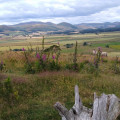
Harbottle Castle and the Drake Stone from Alwinton

An easy circular walk from Alwinton; taking in the ruins of the castle at Harbottle and then up to the Drake Stone in the Harbottle Hills. Descend to Harbottle Lake and return via the forest path. Great views on a clear day.

Technical sheet

2506107
A Alwinton walk posted on 31/08/19 by Alwayswiththehills. Last update : 02/09/19
  • Walking
    Activity: Walking
  • ↔
    Distance: 8.89 km
  • ◔
    Calculated time: 3h 05 
  • ▲
    Difficulty: Easy

  • ⚐
    Return to departure point: Yes
  • ↗
    Vertical gain: + 181 m
  • ↘
    Vertical drop: - 183 m

  • ▲
    Highest point: 298 m
  • ▼
    Lowest point: 141 m
  • ⚐
    District: Alwinton 
  • ⚑
    Start/End: N 55.350939° / W 2.128169°

  • Today’s forecast: … Loading…
Alwinton
Harbottle Lake
Harbottle
The Drake Stone (centre) and Harbottle Hills from the ruins of the castle.

Description

Park at the car park in Alwinton where there are toilets. £2 for a full day in August 2019. There are also some free parking spaces on the right as you drive into the village.

(S/E) From the car park, turn left and walk through the village, bearing rightwards and following the road to cross the bridge. Ignore the road on the left and continue to the Church at Low Alwinton. You will see a track on the left.

(1) Take the track (Park House) past some holiday cottages, pass an interesting and well preserved lime kiln (information board) and continue gently upwards to pass Park House. Go through a field and follow the obvious track to the edge of the wood, walk with the wood on your left, go through a second gate and the start to descend to pass through more woodland (can be muddy). Continue along the track until it has a tarmac surface. Look out for a wooden signpost on the left, pointing back the way that you have come from. Opposite this is a path to a bridge.

(2) Turn right and take the path over the bridge and past the gates to and the garden wall of the most recent castle. The minor road enters Harbottle Village. Continue straight on through the village on the footpath passing the school land village hall on the right. Leave the village and walk to the car park for Harbottle Castle.

(3) Turn right into the car park and pass through the gate following the path across the field and up the motte to the ruins of the castle.

(4) Good views of the Harbottle Hills and the Drake Stone. Return to the car park.

(3) Turn right and walk along the road (no footpath), passing The Old Manse on the left. After this, you will come to a car park on the left.

(5) Walk into the car park and take the signposted track to the Drake Stone, curving uphill through the trees. Pass through a gate and follow the path through the heather. Keep looking back the views are good. Take the path on the left to the gate to the Drake Stone.

(6) Walk around it or dare to take the easy way up the slab facing you as you arrive. From the Drake Stone, pick up the path through the heather which leads to a good view over Harbottle Lake. Descend to the lake and climb over a stile to follow the path just above the lakeside. You will come to the end of the lake beside a wire fence and yellow marker arrows.

(7) Turn right and ascend gently towards the forest. Enter the forest and follow the path which runs in a straight line, de-marked in places by old concrete fence posts. This path can be muddy and you might have to take minor detours to avoid the worst bits. The path exits the forest at a good track.

(8) Turn right onto the good track and cross a cattle grid. Follow the good track (good views) descending gently downhill to the road.

(9) Turn left at the road, cross the bridge and return to Alwinton (S/E) passing (1)

Waypoints

  1. S/E : km 0 - alt. 160 m - Car park
  2. 1 : km 0.79 - alt. 148 m
  3. 2 : km 2.65 - alt. 141 m
  4. 3 : km 3.52 - alt. 152 m
  5. 4 : km 3.79 - alt. 166 m
  6. 5 : km 4.48 - alt. 164 m
  7. 6 : km 5.31 - alt. 273 m - Drake Stone
  8. 7 : km 5.81 - alt. 275 m - Harbottle Lake
  9. 8 : km 6.79 - alt. 255 m
  10. 9 : km 7.66 - alt. 168 m
  11. S/E : km 8.89 - alt. 160 m

Useful Information

There is a pub in Alwinton and another in Harbottle. Both serve food and refreshments.

This walk has some muddy sections and the forest path can remain muddy even after a few dry days. Boots would be my recommendation.

Always stay careful and alert while following a route. Visorando and the author of this walk cannot be held responsible in the event of an accident during this route.

Reviews and comments

4.7 / 5
Based on 4 reviews

Clarity of route description
4.5 / 5
Clarity of route map
4.8 / 5
Walk interest
4.8 / 5
Alwayswiththehills
Alwayswiththehills

Hi
Thanks for sharing this information, it is good to know.
It is possible to check out if the ranges are open and access here, including planned firing times. (I use this info when planning my bike rides through this amazing landscape)

The wood is just on the edge of the range and the land to the north of the wood is open access land.

https://assets.publishing.service.gov.uk...

https://www.gov.uk/government/publicatio...

But you are right when the landowners do not signpost well enough it can spoil a walk. I found the same this last weekend when walking up from Hawkshead in the Lake District and into Grizedale Forrest. It was only when we got there that it became evident that some paths were closed and the diversions were not clearly marked.

Deerplay
Deerplay

Overall rating : 4.7 / 5

Date of walk : 04/05/22
Clarity of route description : ★★★★★ Very good
Clarity of route map : ★★★★☆ Good
Walk interest : ★★★★★ Very good

Easy enough o follow the GPX track provided on my GPS, so didn't need to use the description. There is however a problem in that the section after Harbottle Lake, through the forest has been officially closed by the local council due to storm damage earlier in the year. We didn't know this as there is no signage at the lake end, so we proceeded with quite a bit of difficulty, up over and around fallen trees. An alternative route may involve going round the forest via the military firing ranges (probably not advisable) or returning the way you came and walking along the road.

Elderlywalker
Elderlywalker

Overall rating : 4.3 / 5

Date of walk : 13/05/21
Clarity of route description : ★★★☆☆ Average
Clarity of route map : ★★★★★ Very good
Walk interest : ★★★★★ Very good

This is not an easy walk for elderly (but fit) walkers. It's a steep climb up to the Drake Stone with a narrow and very uneven path. Otherwise a great hike.

Family of 5
Family of 5

Overall rating : 4.7 / 5

Date of walk : 29/12/20
Clarity of route description : ★★★★★ Very good
Clarity of route map : ★★★★★ Very good
Walk interest : ★★★★☆ Good

Lovely views back down the valley while walking and a great panorama from Drake stone. We walked this in very cold, bright weather. It was icy on all of the slopes and Harbottle lake was frozen. Luckily the cold helped the forest part of the walk, which would have been really muddy in warmer weather. Took perhaps 2 hr and 15 mins rather than 3 hours, including stops to admire the views, but all 5 walkers are adults.

Visorambler
Visorambler

Overall rating : 5 / 5

Date of walk : 12/10/20
Clarity of route description : ★★★★★ Very good
Clarity of route map : ★★★★★ Very good
Walk interest : ★★★★★ Very good

Able to start this walk from our accommodation. Good pathways. Getting to the Drake Stone was quite tough and no real path to follow, however we made it to the top.

Other walks in the area

For more walks, use our search engine.

The GPS track and description are the property of the author.

Loading…